This Blog, the third in our
‘Autumn 2018’ series, continues the coverage of our exploration of the northern
coast of Greece.
 |
| Chart showing progress to date in Northern Greece |
Our cruise and this Blog encompass
the Khalkidhiki Peninsula, one of the most prominent geographical features in
the Aegean with its three smaller southern peninsulas of Akti, Sithonia and
Kassandra, which extend like fingers from the hand of Khalkidhiki into the
North Aegean Sea.
 |
| Chart showing route taken around the Khalkidhiki Peninsulas |
With the exception of the
Kassandra peninsula to the west, the peninsulas are very mountainous with Mount
Athos, at the foot of the Akti peninsula, rising sheer from the sea to a height
of 2033 metres (6670 feet).
The countryside throughout the
peninsulas is densely wooded, mostly with pine but also with wild olive, hazel,
oak and poplar. In many areas trees
grow down to the water’s edge and shade what many consider to be some of the
finest beaches in Greece.
GULF OF SINGITIKOS
The Gulf of Singitikos lies
between the Akti and Sithonia Peninsulas.
It was our target area from Limenaria (in THASSOS).
Our passage from Limenaria into the
Gulf of Singitikos was a 60-mile (12-hour) sail. We therefore left Limenaria at
3 a.m. to ensure that we rounded the Akti Peninsula, saw Mt Athos and moored
(or anchored) in daylight. It turned out to be a rather lumpy downwind trip
until we rounded the cape and entered the Gulf, at which stage the sea
flattened out completely.
AKTI PENINSULA
The rugged peninsula of Akti has
existed in a world of its own for ten centuries. Central to Greek Orthodox beliefs, Mt Athos at the foot of the
peninsula is considered to be a holy mountain.
A monastic community lives on and has jurisdiction over the
peninsula.
 |
| Mount Athos seen from south of the Akti peninsula |
We understood that there are no
roads, mains electricity or telephone network on the peninsula. From our own observation, however, there was
no shortage of solar panels or lights.
We don’t have any information on mobile networks although our phones
picked up a full signal!
Many of the monasteries occupy
spectacular sites on rocky bluffs or cling to precipitous cliffs. The buildings vary considerably in size and
condition. Our overall impression was
that many of the buildings looked empty and that the number of buildings far
exceeded the needs of the number of people said to be in the monastic communities.
 |
| Monastery perched precariously on the cliffside |
Hermits and ‘vagabond’ monks often
live in inaccessible locations on the cliff sides. While we saw monks, we did not see any hermits – but then one
wouldn’t expect to!
 |
| Hermit’s ‘skete’ |
Time on the peninsula is still
reckoned by the Julian Calendar (13 days behind the Roman one) and days are
ruled by the Byzantine Clock with hours of variable length!
If one is male, it is possible to
visit the peninsula on either a conducted tour, or, independently with a
permit, travel between monasteries or stay for up to four days in a monastic
community. Women, however, are most
definitely not permitted on the peninsula!
No permit is
necessary to sail around the coast. One
cannot, however, use the monasteries’ small ports or the anchorages. Indeed, there is a 500-metre exclusion zone
for all boats (or a kilometre if women are on board).
The weather around the capes of
each of the three Khalkidhiki fingers (particularly Akti) can be very rough and
subject to violent down draughts.
Yachts are advised to reef early if in any doubt. Fortunately we went round the cape of Akti
in reasonable conditions and had no problems.
Ammouliani
Once round the cape, we sailed
north up the monastic coast of the Akti Peninsula to the island of AMMOULIANI,
one of the first places where we could stop after the peninsula’s restricted
holy area ended. It is also an
attractive and popular resort for Greeks and has a range of anchorages
available in the event of its two small ports being too full or too
shallow.
After a recce of options, we
pulled into the small, very shallow caique harbour used by both local fishing
boats and a few larger offshore vessels. There we moored on the quay. Well protected from the elements, the
harbour is only one kilometre away from the small village of Ammouliani itself.
 |
| ID on the quay in Ammouliani fishing harbour |
Just as the sun was setting below
the yardarm and we had started to enjoy a G&T, Vassileos – a local man who
worked in the tourist industry and spoke excellent English – tactfully
suggested that we should move along the quay and raft on a large fishing boat
that was currently out of action, rather than offer ourselves up as a fender to
the larger fishing boats that were likely to return during the night! He even gave us a hand moving.
 |
| Rafted safely on an out-of-service fishing boat |
During the night a large
Greek-owned/skippered purse-seiner, crewed by ten Egyptians (increasingly, we
were told, at a wage of 400€ per month, this is becoming standard practice on
many larger boats in Greece) moored on the quay behind us in the spot we’d
previously been! It didn’t even wake us
up! Next morning we bought a bag of
fish for 10€ from Mohammed, the ship’s Egyptian mate. The fish provided us with three meals each.
 |
| Mike purchasing fish from Mohammed, the Egyptian mate of our neighbouring purse-seiner |
Before leaving, we walked into the
village to look around and stock up. It
was a very pleasant place but appeared almost empty of people – which was
probably the case as it is now out of season.
 |
| Main street in Ammouliani leading down to
one of the two harbours
|
To our surprise, the owner of one
of the village’s two ‘super’ markets spoke excellent English – as indeed he
should, having studied Sociology (“It was the fashion in 1993!”) at the
University of Essex in Colchester (where Mike had been at boarding school).
Small world.
THE ‘DIMITRI’ ISLANDS
In order to get out of the very
shallow port and not risk damaging our rudder, we warped the boat round with
long ropes so that we could exit forwards rather than in reverse.
Thereafter, we simply motor-sailed
around the top of AMMOULIANI and then the twenty miles west across the Gulf of
Singitikos to the ‘Dimitri’ islands on the east coast of the Sithonia
Peninsula.
There we anchored in the northeast
corner of DHIAPOROS Island at the head of the relatively long and narrow bay of
Kriftos.
 |
| Google Earth overview of DHIAPOROS Island and mainland. Arrow indicates Kriftos Bay where we anchored |
It was an exceptionally pleasant
location, made even more so by the fact that we were the only boat and people
in sight. The anchorage provided good
all-round protection together with peace and tranquillity.
 |
| ID at sunset in Kriftos Bay |
The Dimitri island group and
mainland coast are popular with Greeks who want their own space – and can
afford it. Not surprising therefore that the area is locally referred to as
‘The Greek Riviera’.
After a relaxing afternoon at anchor, we launched the dinghy
and rowed ashore to look around. That
evening we enjoyed our first helping of the fish we had bought from Mohammed in
Ammouliani, before watching ‘Strictly’!
(We can, incidentally, thoroughly recommend the VPN ‘Nord’ ® which allows us to watch UK TV on the few occasions
that we do [Strictly, Rugby and sometimes the News!].)
In the morning we weighed anchor
and motored north out of the bay before heading around and then through the
channel between DHIAPOROS Island and the mainland. We understand that there are
several good anchorages and coves on both sides of the channel.
We finally exited the channel
through the narrow, shallow Southern Passage before heading south down the east
coast of the Sithonia Peninsula towards the bay of Sikias.
Skala Sikias
The coastline south is comprised
of steep cliffs (although not as steep as on the Akti Peninsula) and has a few
sandy bays at intervals. It is heavily
wooded with a mountain ridge running north–south like a spine down the centre
of the peninsula. A few of the bays are
‘developed’ but only to a very limited extent.
Independent campers and caravanners were using some of the others.
 |
| One of the attractive beaches being used
by
independent campers and caravanners on the east coast of Sithonia Peninsula
|
We motored in bright sunshine,
negligible wind and calm sea to Sikias. As we approached, however, some
serious-looking thunderclouds developed so we decided to go straight to the
secure anchorage at Skala Sikias rather than passing a few hours anchored off
the beach as we’d originally intended.
 |
| Google Earth overview of Sikias Bay with arrow indicating Skala Sikias cove where we anchored |
No sooner had we dropped anchor
behind a small mole than the heavens opened for an hour or so with heavy rain
and thunder.
 |
| When it rains in Greece, it rains |
Thereafter, although no more rain
fell it was overcast so we gave up the idea of going ashore, battened down the
hatches and had mince, mashed spuds and baked beans for supper (ship’s ‘cottage
pie’).
Next morning it was hot and sunny
again. We rowed ashore and strolled
around the port and hamlet, which is located in a pleasant little cove a short
way east of the main resort, which lies behind the long beach of Sikias
Bay.
 |
| ID at anchor in Skala Sikias |
We then took our daily exercise by
walking to and then along the road backing the golden sandy beach. On the other side of this road there was a
series of large empty caravan and campsites, although a few vans had obviously
been left on site for the winter. It
all looked a bit scruffy but then it is out of season. There were also what appeared to be cheap
rooms and tavernas along the road.
 |
| Sikias Bay’s enormous sandy beach |
The studios and tavernas nearer to
our anchorage at Skala Sikias were clearly more upmarket than those along the
beach.
 |
| One of the smarter studio apartment buildings |
On our way back to the boat, Helen
swam in the crystal-clear water of the small cove of Linaraki, which is backed
by a couple of smart studio complexes with their own small taverna.
 |
| Helen swimming in Linaraki bay, Sikias |
GULF OF TORONAIS
The Gulf of Toronais lies between
the finger peninsulas of low-lying Kassandra to the west and mountainous
Sithonia to the east.
Porto Koufo
After winching the dinghy on board
and weighing anchor, we motored from Sikias around the tip of the Sithonia
Peninsula to Porto Koufo on the southwest corner of the peninsula’s west coast.
The area at the south of the
peninsula is not dissimilar to that on the east coast, although it is
significantly more rugged, eroded and is hardly inhabited. Dramatic collapses and rock falls from the
500-ft cliffs over the centuries have altered the coastline and charts mark
such areas as ‘not safe’ to explore.
Porto Koufo is generally
considered to be one of the most magnificent natural harbours in the
Mediterranean in terms of both protection and scenery.
 |
| Google Earth overview of Koufo harbour with arrow indicating the pier out from the quay where we moored |
The harbour’s narrow entrance
between two high sea cliffs opens up into an almost land-locked bay protected
by cliffs and wooded hills. Once only a
small fishing harbour it now also caters for a small number of holidaymakers
and for day-trippers in coaches. In
the winter the tunny fleet use the harbour as a base.
At the south end of the bay there
are a few small tavernas, bungalows, rooms to rent and one smart hotel. The village and port of Porto Koufo are at
the north of the bay, which is well protected by high wooded hills.
 |
| View of Koufo harbour from an olive grove
on
nearby hillside
|
Indeed, our principal reason for
going there was to find shelter because it had become increasingly obvious that
bad weather was still expected.
 |
| The forecast for Thursday 25 October and the subsequent gale confirmed our earlier concerns [www.windy.com] |
For those cruisers among you, if
you look at Windy’s weather chart above you can see that WE, in Porto Koufo,
were hardly affected by the Meltemi [gale] that was generated in the Black Sea
(northeast of the Aegean). What happened was that at the same time a more
powerful ‘Vardaris’ gale developed in the Axios River basin, which flows into
Thessaloniki, the Thermaikos Gulf and to the
Aegean. In consequence, our friends in the south Aegean ended up getting a
double whammy, while we basically got away with it, being on the edge of the
Vardaris, the centre of which was in the next gulf west of us (Thermaikos).
After reviewing our limited options,
we rafted on a Greek Beneteau berthed at the root of the larger of the two
piers running out from the port’s quay.
 |
| ID rafted off one of the piers in Porto Koufo with a large protective hill to the south |
Each night, two large fishing
boats berthed on the quay ahead of us and unloaded their catch into waiting
refrigerated lorries.
 |
| The fishing boat’s mixed fish catch, having been cleaned, sorted, boxed and iced, about to be loaded on to a lorry ready for market |
 |
| Greek skipper and mate checking their nets before having repairs effected and then putting to sea again |
One morning a smaller fishing boat
arrived and unloaded an amazing catch of some 30 or more swordfish, each of
around 20 kilos. After being weighed
and tagged, these were taken away in a large refrigerated lorry to one of the
cities’ markets.
 |
| An enormous catch of swordfish |
Two days later, as forecast, the
northerly F7 gusting 8 came through overnight (and we were only on the edge of
it!). Even the big fishing boats came
back into the port at sunset to avoid what was coming. The harbour proved as sheltered as
advised. We even slept reasonably well
– once the wind generator was turned off!
 |
| Even the large fishing boats took shelter
from the overnight gale
|
Gerakini
Our 30-mile passage up and to the
head of the Toronais Gulf was in negligible winds and calm waters.
 |
| No wind, no waves but plenty of sun |
There was a noticeable contrast
between the mountains of Sithonia and the low-lying profile of the Kassandra
peninsula. Probably, in consequence
Kassandra is significantly more populated.
We anchored close to the shore in
the open anchorage off Gerakini’s sandy beach and holiday resort. It was only 5 miles from the Portas Canal,
which we planned to transit next morning as a shortcut on our way to
Thessaloniki.
 |
| Anchored off Gerakini beach |
Skala Gerakini was precisely as
described in the various travel guides – a beach resort that doesn’t pretend,
like some do, that it was once a fishing village. Admittedly we are well out of season but our overall impression
was that it was a very pleasant resort with plenty of nice apartments, studios
and rooms for rent, and, if you wanted it, an impressive large fenced hotel,
which fronted a manicured portion of the beach. It is part of the Ikos hotel group.
 |
| The other half of the beach front where we anchored had small studios and apartments |
That evening we watched a
magnificent sunset, which silhouetted Mount Olympus, Greece’s highest mountain,
some 40 miles to the west.
 |
| Glorious sunset silhouetting Mount Olympus |
Portas Canal
Next morning we were up at 6 a.m.
and weighed anchor at first light before heading 5 miles towards the entrance
of the Portas Canal, which splits the Kassandra peninsula from the
mainland. It is half a kilometre long,
has a minimum width of 36 metres, is dredged to a minimum depth of 2.5 metres
and – crucially – is said to have a vertical clearance of 17 metres.
 |
| Google Earth view of Portas Canal |
In Porto Koufo we’d re-measured
the height of our mast in anticipation of passing under this bridge. It was still 15.55 metres from the
waterline! Theoretically, therefore, we
had 1.45 metres to spare. It certainly
didn’t look like it as we got close to and motored slowly under it – but it
was!
 |
| Near to the bridge we seriously questioned
whether we’d get under it!
|
 |
| Beginning to pass underneath the first of the two bridges |
After we’d successfully passed
under the two bridges and exited the canal into the Gulf of Thermaikos, we both
breathed more than a sigh of relief and rewarded ourselves with a ‘deck’ coffee
with a double helping of the ‘trimmings’!
GULF OF THERMAIKOS
The Gulf of Thermaikos is enclosed
by the Western Sporades100 miles to the south, the massive mountain ranges,
including that of Mt Olympus to the west, and by the relatively low-lying
Kassandra Peninsula to the east. The
Gulf terminates in the smaller Bay of Thessalonikis in the north.
Thessaloniki
Once we’d exited the canal we
turned north and headed up the west coast of the Kassandra Peninsula towards
Thessaloniki, the second largest city and port in Greece. On passage we noted the coastal ribbon
development that has taken place on the west coast of the Kassandra Peninsula.
 |
| Google Earth view of Thessaloniki and its bay |
Thessaloniki became a major city
due to its excellent natural harbour and its location at both the gateway to
mainland Greece and on the Via Ignatio between present day Italy and Turkey.
The Greek part of Macedonia, of which Thessaloniki is the capital, only became
part of the Greek Republic, following 400 years of Ottoman (Turkish) rule,
after the Balkan Wars in 1912. Indeed,
the Greeks only became the predominant nationality in the city after the
population exchanges with the Turks in 1922.
Ataturk was born in Thessaloniki
(then known as Salonica) and from there planned the Young Turk Revolution that
eventually led to the foundation of modern Turkey in 1923.
Most visiting yachts, including
ourselves (given no real alternative), end up berthed in the municipally run
marina in the pleasant grassy and wooded high-rise suburb of Kalamaria, some 7
miles southeast of the city’s centre.
 |
| Approaching the marina in Kalamaria,
a
leafy green suburb of Thessaloniki
|
The solid all-concrete marina,
while soulless, is spacious and provides excellent shelter. It is used as an over-winter base by a
number of charter companies, larger yachts and ‘gin palaces’. Unfortunately, it is somewhat run down,
poorly managed and the facilities are totally inadequate.
 |
| Thessaloniki marina from Kalamaria’s main street above |
We came to Thessaloniki for ‘Oxi’
Day! Greek communities all over the world celebrate 28th October each year,
being the date on which the Greek Prime Minister at the time, Ioannis Metaxa,
rejected Mussilini’s ‘request’ to station Italian troops in strategic locations
in Greece in 1940. Subsequently Greek
troops, reinforced by Commonwealth forces, resisted their attempts to implement
their ‘request’ by force – before Axis troops took over and did the job for
them.
The celebrations in Kalamaria,
where we were, were on a grand scale with a stand for visiting dignitaries,
bands and a march-past of groups in costumes representing the different
nationalities that make up the city’s population, youth groups and school
children. The main street was lined
four-deep.
 |
| Oxi Day band from the dignitaries’ stand
(where Helen had established herself)
|
 |
| Oxi Day street scene |
The Greek military played their
part with a spectacular low-level, ear-splitting fly-past of helicopters and
fighter jets, including the Eurofighter Typhoon.
 |
| Two of the helicopters that deafened the crowd |
In the city itself a similar
celebration took place but on an even larger scale. It was attended by the Greek Prime Minister Alexis Tsipras and
the Italian President Sergio Mattarella as a symbol of solidarity between their
two countries. Had we known about this
earlier, we might well have caught a bus into the city to see that parade.
 |
| Greek Prime Minister and Italian President representing their respective countries on Oxi Day [Greek City Times] |
A wide ethnic mix populates modern
Thessaloniki. It has a prosperous air
to it, stimulated by two major universities and a famously avant-garde music
and entertainment scene. Local food is
supposed to be some of the best in Greece.
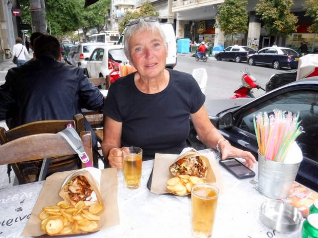 |
| About to enjoy some street food |
In recent years the waterfront has
been renovated and considerable effort has been made to reduce the industrial
levels of pollution.
 |
| Thessaloniki’s waterfront is now a
popular place to promenade
|
The city is now a bustling,
likeable place well worth exploring.
Throughout there are still many examples of Byzantine, Ottoman and
Venetian architecture and culture, even though much of the city was destroyed
by the Great Fire of 1917.
We caught a No 5 bus from outside
the marina into the centre of the city.
The main sights are all within walking distance of the waterfront and
you can take an open-top ‘Hop On, Hop Off’ bus to explore further out. The top sights in our view were the White
Tower and the Archaeological Museum.
 |
| The White Tower is Thessaloniki’s iconic landmark. Once the southwest tower of the city’s fortification wall, subsequently a prison for lifers, it now hosts an excellent permanent audio-visual exhibition on the city’s history |
 |
| The nearby Archaeological Museum concentrates on explaining the culture of Macedonia as a whole up to late Antiquity through exhibits and multi-media presentations |
Platamonas
From Thessaloniki we commenced our
return sail south back to Leros, initially down the mainland coast of the Gulf
of Thermaikos towards the town and port of Platamonas. We’d camped near there way back in 1970!
The dominant feature of the Gulf
is undoubtedly the mountain ranges of the mainland, which stretch from the
provinces of Greek Macedonia in the north to Thessay in the south. The nine towering peaks of the Mount Olympus
range all exceed 2680 metres (8800 ft) – the highest range in Greece. From autumn to late spring they are covered
in snow and indeed there is snow in the higher gulleys now.
 |
| Mount Olympus seen from Savvi Marina in Platamonas |
Although there are other mountains
in Greece also called Olympus, these are the ones famously associated with The
Gods. Here Zeus ruled and the Gods
dined, played, drank and argued in what the mortals below believed was the
ultimate in terms of ‘the good life’.
It is said that the mountain peaks are shrouded in cloud (which from our
experience seems to be an almost permanent situation) so that mere mortals
can’t see what the Gods are getting up to!
 |
| Marina, town, surrounding area and
Mount
Olympus (shrouded in cloud)
|
The old fishing harbour, now a
marina, of Platamonas, which lies on the west of the Gulf, has been
significantly improved since we drove to and camped nearby in 1970 in the
shadow of Mt Olympus. The new
breakwater, improved shelter, quays, pontoons and ‘facilities’ have totally
changed it – as indeed has the new promenade, smart holiday accommodation and
quayside restaurants.
The Castle overlooking the town is
lit up very effectively at night. As
cruisers arriving in the dark, we found it to be a good navigational aid!
 |
| The 10th-century Castle that overlooks Platamonas, ideally positioned to control movement along the north–south highway as then existed |
We caught a local bus north along
the coast road and were delighted to find ‘Castle Camping’ where we’d
previously stayed under the shade of plane trees just back from the beach.
 |
| Castle Camping 48 years on! |
Today, ten campsites share the
beach – things have moved on! Truth is
we preferred it as it was. There wasn’t
much there, if anything, that we did remember other than the beach and castle
overlooking it. Mike, however, found an
old ice-cream fridge, which he is convinced is the same one from which he
obtained his daily supply of cold Retsina!
(Then it was the only cold drink available on the beach!)
 |
| Mike with ‘his’ old Retsina fridge! |
The beach, which runs for 5 miles
to the end of the peninsula, is one of the longest in Greece.
 |
| Castle viewed from Castle Camping beach
|
GOING FORWARD
We now plan to push on south back
towards LEROS in order to decommission Island Drifter and catch our flight
back to the UK on 20 November. What
route we take will depend on the winds.
As a first step, we aim to go from Platamonas to SKOPELOS in the Western
Sporades. We visited this island in the
early summer with our friends Max and Sue Walker and subsequently with Peter
Coy.
Glad you are still enjoying Greece :-) now you can see why we are still there. Hopefully we can catch up when you are back in good old blighty :-) xx
ReplyDelete